Our Watershed

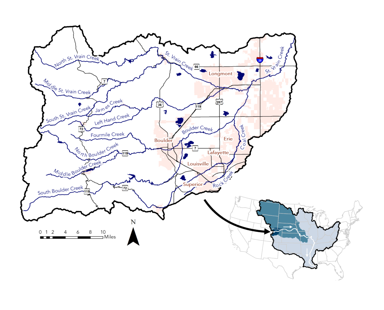
Map of the Boulder St Vrain Watershed. Smaller streams in the mountains to the east converge into the main waterways that flow through cities as they flow westward. St. Vrain Creek flows through Longmont. Boulder Creek flows through Boulder and into St. Vrain Creek. Coal Creek flows through Louisville and Lafayette and into Boulder Creek.

The Boulder St. Vrain Watershed

The Boulder St. Vrain watershed is a subwatershed of the South Platte River basin, which is part of the Mississippi River basin. That means that any water that isn’t diverted elsewhere flows from our watershed into the South Platte River, joins the Platte River and then the Missouri River, before flowing into the Mississippi River and eventually the Gulf of Mexico. A complicated network of ditches and diversions is built on top of this system, carrying water across the Continental Divide or distributing it to individual properties, but our watershed still connects us with everyone living upstream or downstream along these waters.
Learn About Our Watershed

Overview

Geology, land use, and other factors play an important role in local water quality.

Issues

Most watersheds have some water quality issues and ours is no exception.

Monitoring

We keep a close eye on water quality in our watershed to identify issues and opportunities for improvement.